Tama River Cycling
Cycling along the Tama River was one of my favorite activities when I lived in Japan. So I decided to spend a month in Tokyo, getting back on a bike and exploring the Tama River Trail again. Before my arrival, I had checked a few Tokyo cyclist groups to see about bike rentals but there was very little out there, and what there was really wasn’t cost effective so I decided to look for a used bike. Shortly after my arrival, I found a nice Bianchi on Craigslist and though it’s a bit more of a hybrid than I like, I didn’t have a lot of time so I bought it. Then the challenge was getting the bike from its owner in Tamachi station back to my temporary apartment in Tachikawa.

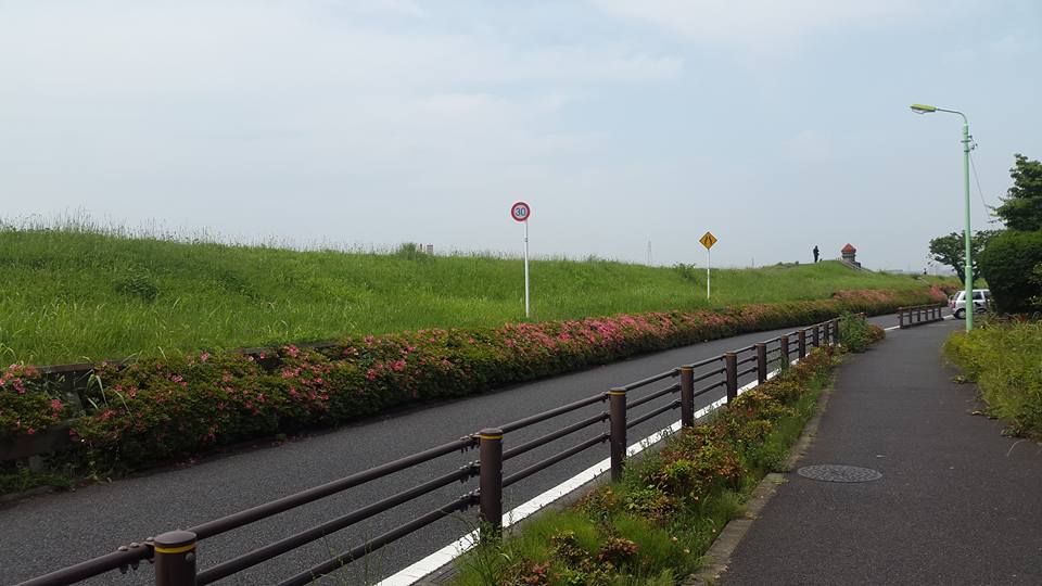
A quick look at the Strava map will make it clear that I didn’t chose the most direct route. The reason I chose to stay in Tachikawa for this trip is its close proximity to the Tama River. There is a cycling path along the river about 30 miles long and though it gets crowded on the weekends, during the week it’s pretty empty. About ten years ago when I lived near Tamagawa station, I would ride along this bike path on most weekends.
Cycling on the roads in Tokyo is not really a big deal. Cyclists friends of mine who are more familiar with bike friendly, mostly European, cities have some complaints but compared to most of the world, I’d say it’s pretty safe and easy. There are so many bicycles on the roads that drivers are very aware of them, and that helps a lot.
I had arranged to meet George, the owner of the bike I was buying, at Tamachi station at 6AM, before he headed to work. That meant catching the first train at around 4:30. I got to the station and waited, and when George pulled up on the new bike, I couldn’t help but smile. There’s just something about being on a bike that makes me happy. I put on my helmet and gloves and started pedaling. I wasn’t worried about getting lost or battling traffic. I was just enjoying the motion of my legs, the shifting of the gears. The feel of the cool morning air.
I have not beeen blessed with a very good sense of direction. I get lost constantly. So naturally, I got turned around a bit at the beginning of the ride. My goal was just to head south until I crossed the bridge into Kawasaki and then pick up the trail along the river. After about 8 miles, I saw a bridge. Hey, at least I made it to the river. The rest should be easy. I wasn’t sure if bikes were allowed but then I saw a narrow gap where bikes were coming and going. Along the bridge, there’s a nice view of the river and a bit of the skyline but I was on a mission and didn’t want to stop to take it in.

Along the river, the trail thins out in a few places. So either you hop onto the nearby road or you ride along a narrow dirt path under low-hanging rail bridges and past a few homeless encampments. Ten years is a long time and I didn’t remember the exact route I used to take. Eventually, the trail I was on ended and the path became narrow with high grass, just a few feet from the water’s edge. The trail appeared to be getting more and more narrow. I followed an older man, thinking he knew where he was going. He stopped, got off his bike and stared out at the water. I decided to approach him. He very apologetically moved his bike off the path so I could get by. Trying to remember my Japanese, I asked him if the trail continued to go straight or if it stopped in the grass. He asked where I was headed and when I told him Ichikawa, he became very excited and using a combination of hand gestures and Japanese, I was able to understand that I needed to cross the bridge back to the Tokyo side. But he kept saying “two” (I don’t remember now if he said it in English or Japanese) and I didn’t understand what he meant by it. Until I got back on the road and came to the next bridge and realized it was an elevated road and not accessible. So I had to go to the second bridge (that was the “two”) and then cross over to the Tokyo side.
The trail in Tokyo is in great condition at that location: new, smooth pavement with clearly marked sections for pedestrians and cyclists. A lot more lycra-clad cyclists were on the trail than when I used it a decade ago but it’s still mostly school kids and moms with their kids in plastic bike seats in the back. As you ride, if you look off to the side roads, you’ll find plenty of vending machines. Pocari Sweat and cold green tea fueled most of my ride.

I checked the map on my phone every now and again and saw I was getting closer. Near Tachikawa, the trail ends in what seems like a private road. There were two cyclists in front of me that I followed along a rather roundabout detour, down a few small streets and over a wooden bridge then back onto the trail. From there, it was not long before the turnout and along a few more small streets until I pulled up in front of the apartment. Four and a quarter hours. Thirty seven miles. Not bad.

